Photos depict: Himalayas
Location: above the region of Calcutta – above Bara Pushkarini, flight QR 976 from Doha to Hanoi, and 23°43’26.7″N 86°35’18.1″E – above Barmuri
Observer’s Altitude: 12,400 meters – cruising altitude
Distance: Kanchenjunga ~ 522 km Simulation – Kanchenjunga SimulationMount Everest Simulation
Date: February 23, 2019, flight QR 976 from Doha to Hanoi
Author: Radek Grochowski
Description: This is probably a world record in long-distance aerial observations.
Excerpts from the author Radek Grochowski.
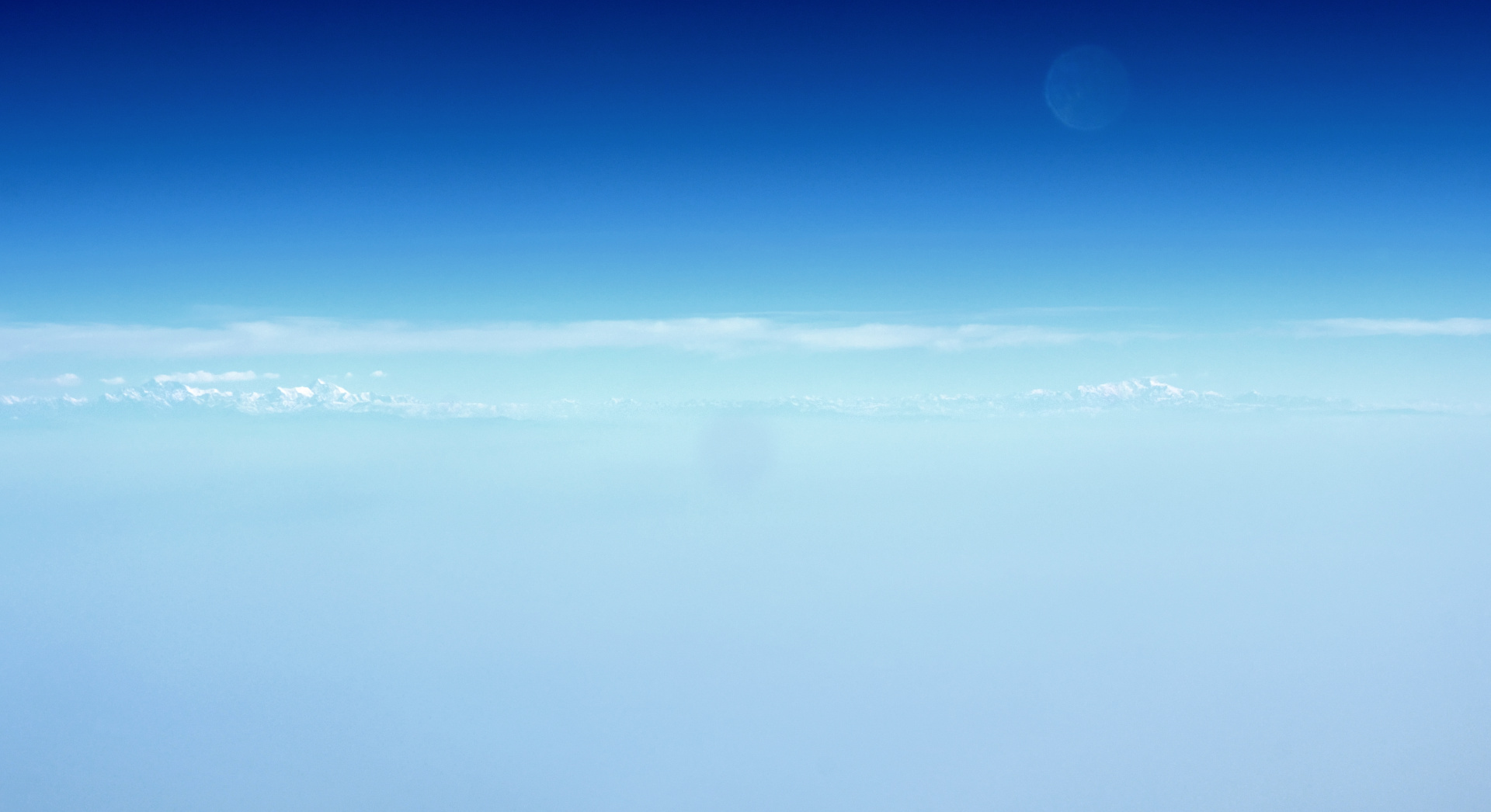
„Theoretically, a passenger plane flight at an altitude of over 10km offers the opportunity to see very distant objects, but in reality, many conditions must be met, so it is rarely possible to see something truly interesting. Most often, there is simply nothing sufficiently characteristic on the horizon, and even if there is, the air may not be clear enough, clouds may be too high, lighting conditions unfavorable, the window glass may be frosted, etc. And even if everything is fine, the window seat may not be available.
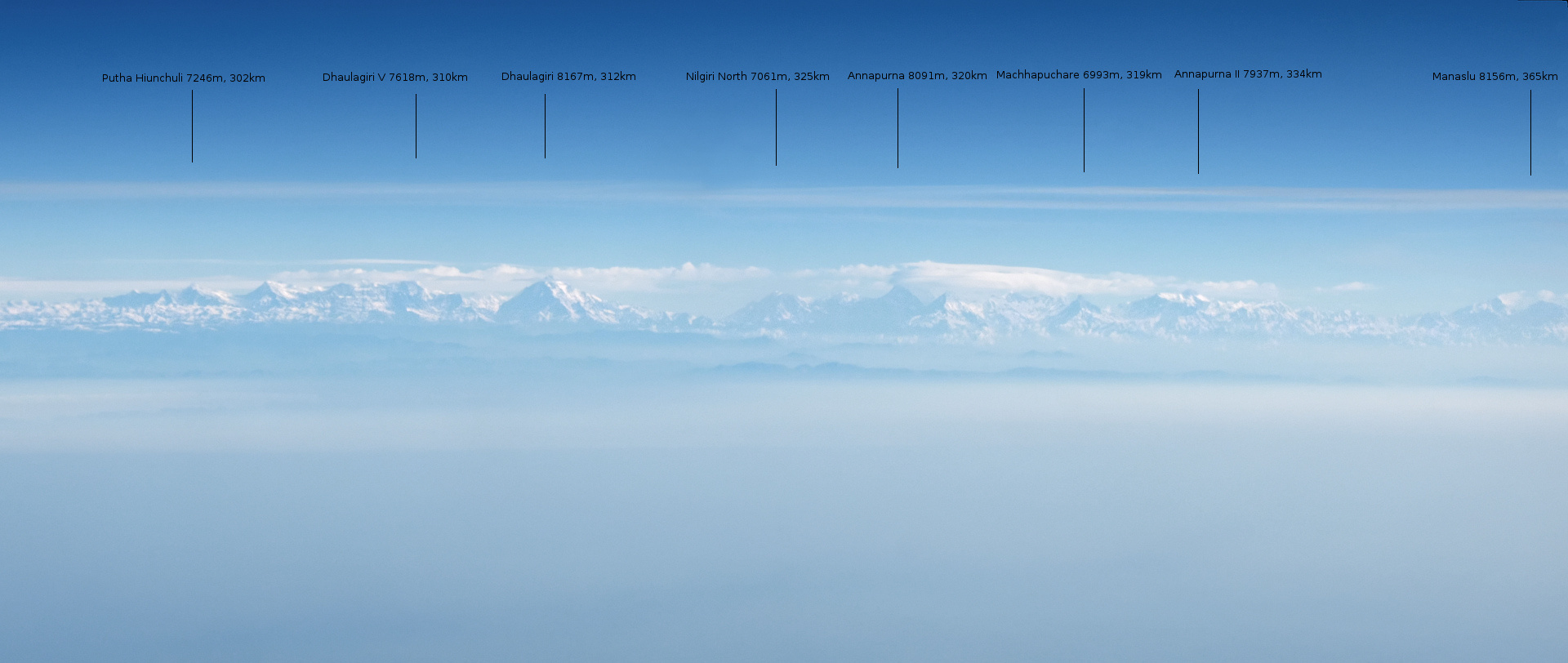
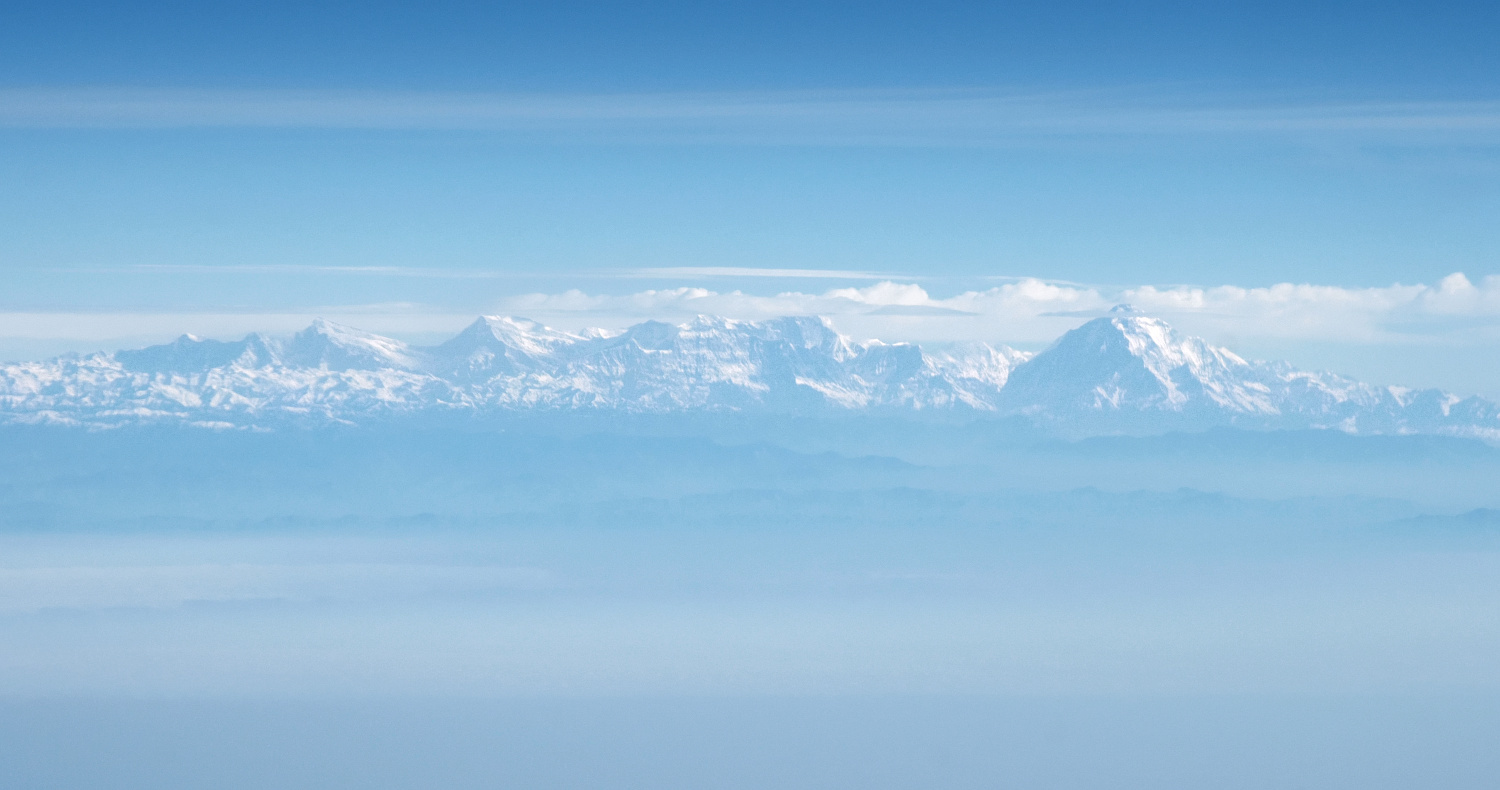
Next was the leg from Doha to Hanoi. Half of the flight was supposed to be at night, and the rest during the day. Much earlier, I checked that the plane would probably fly close to the Himalayas, so I reserved a window seat on the left side. It was the third flight in a row, so at some point, I just drifted off without even setting an alarm. I thought I had only slept for a moment, but when I woke up and raised the window shade, the Sun was high, and in front of me, the Himalayas looked beautiful. I immediately recognized the characteristic pyramid of Dhaulagiri, and to the right of it, the massifs of Annapurna and Manaslu.”
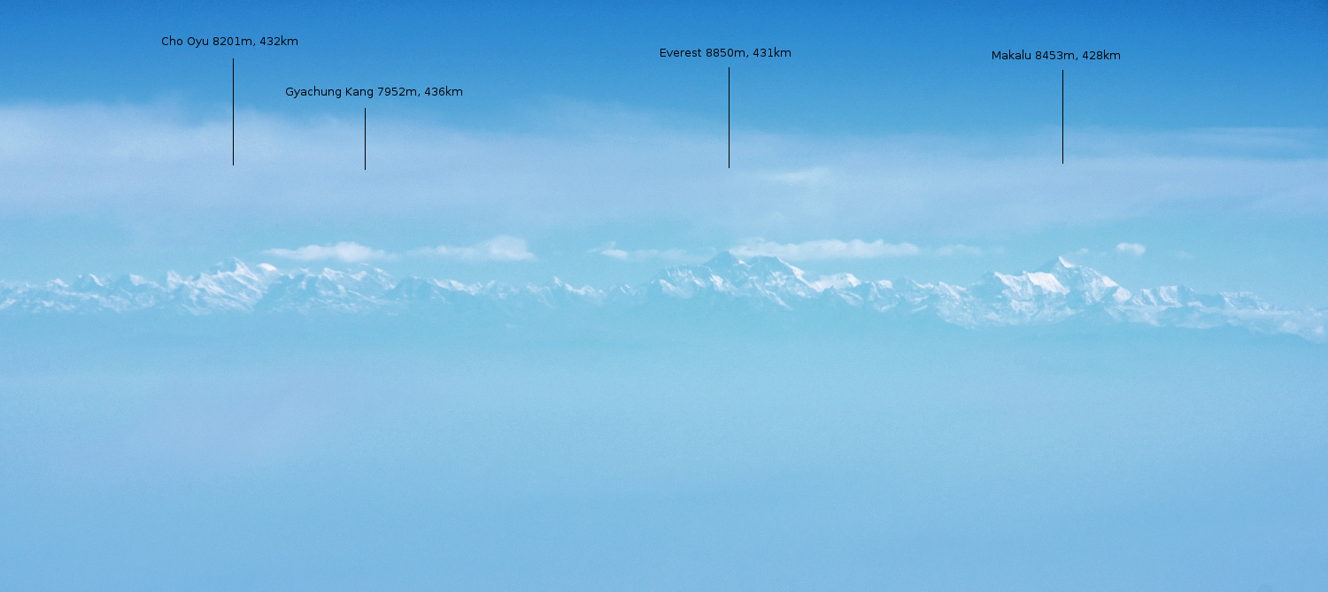
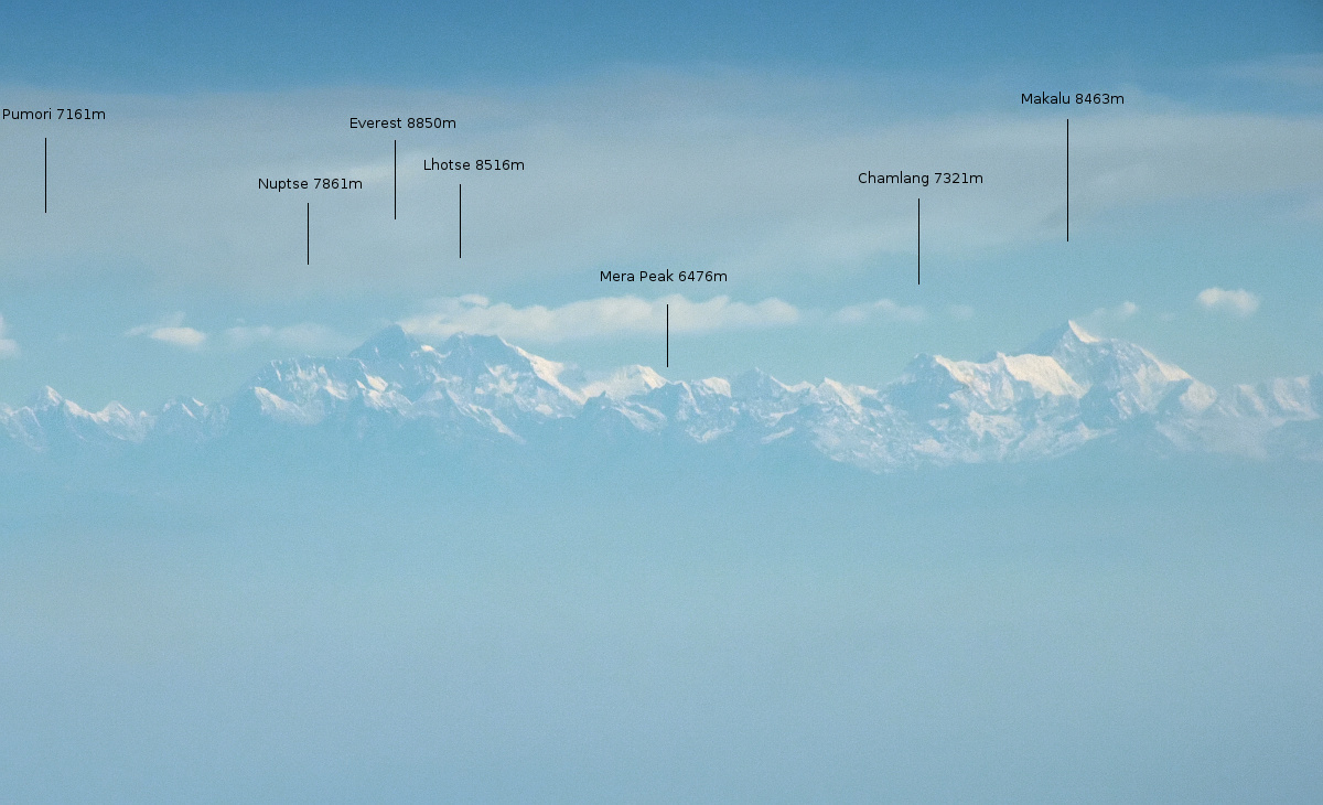
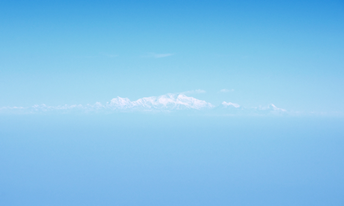
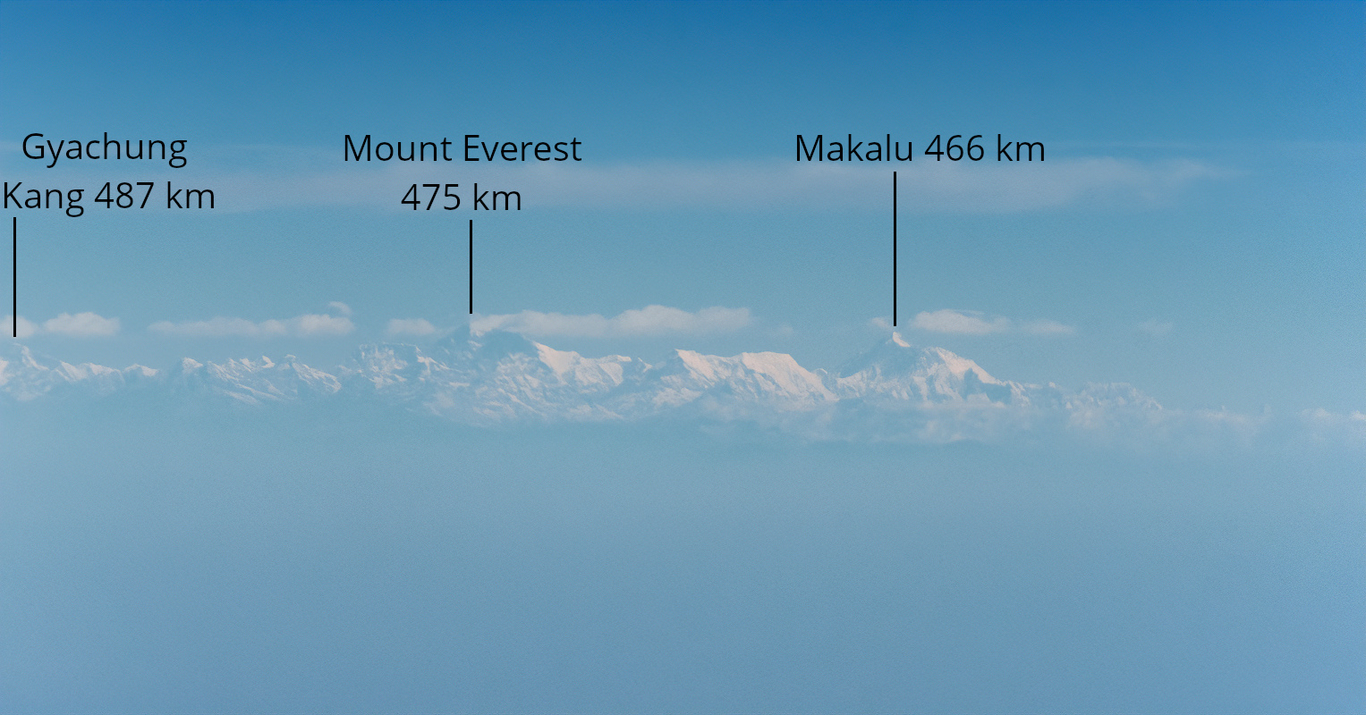
„From that point on, we were still moving away from the Himalayan range. After some time, we passed by Cho Oyu, Everest-Lhotse, and Makalu, which were already at distances of over 400 km but still perfectly visible. The second photo shows a close-up of the Everest area with peak descriptions.”
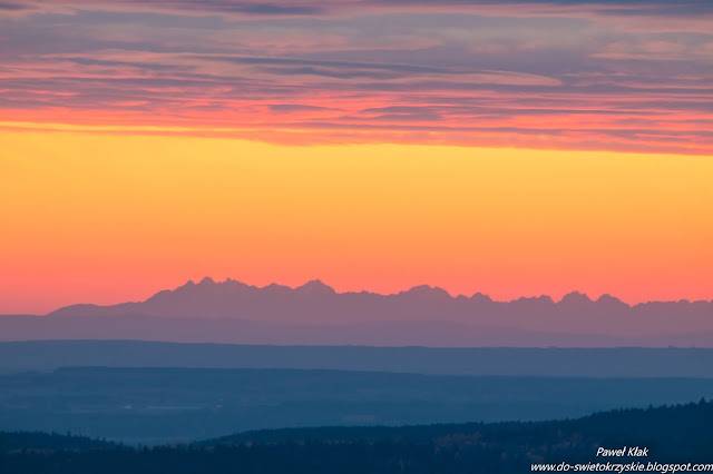
„The last photo of Kanchenjunga was taken from a distance of 522 km. Despite this, it was still perfectly visible.”
Estimated location: above Bara Pushkarini
Radek also sent a photo taken 9 minutes earlier before the Kanchenjunga photo from the location 23°43’26.7″N 86°35’18.1″E. It features Gyachung Kang at 487 km and Mount Everest at 475 km.
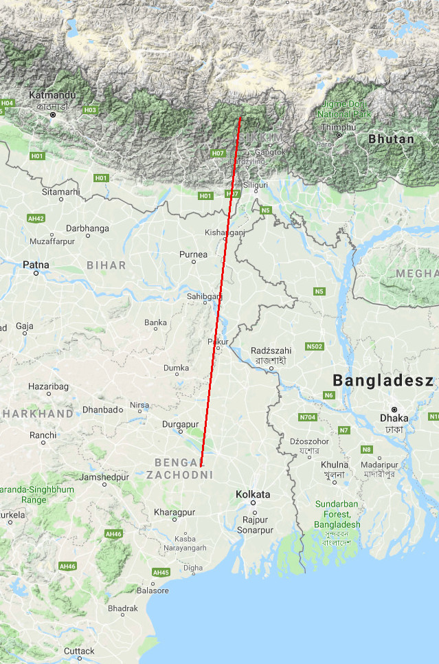
„But that’s not the end. Right after that, breakfast was served, and I couldn’t take photos, but by contorting my neck over the tray, I could still observe. I saw the Himalayas for the last time from above Calcutta. The distance to Kanchenjunga was 570 km at that time, and to Everest, a whopping 620 km.
God only knows how much longer they would have been visible if the plane over Calcutta hadn’t flown into high cirrus clouds…”
Unfortunately, Radek no longer has photos from over 600 km.
[…] [520 km] Photos of the Himalayas from over 500 km from an airplane over Kolkata. […]