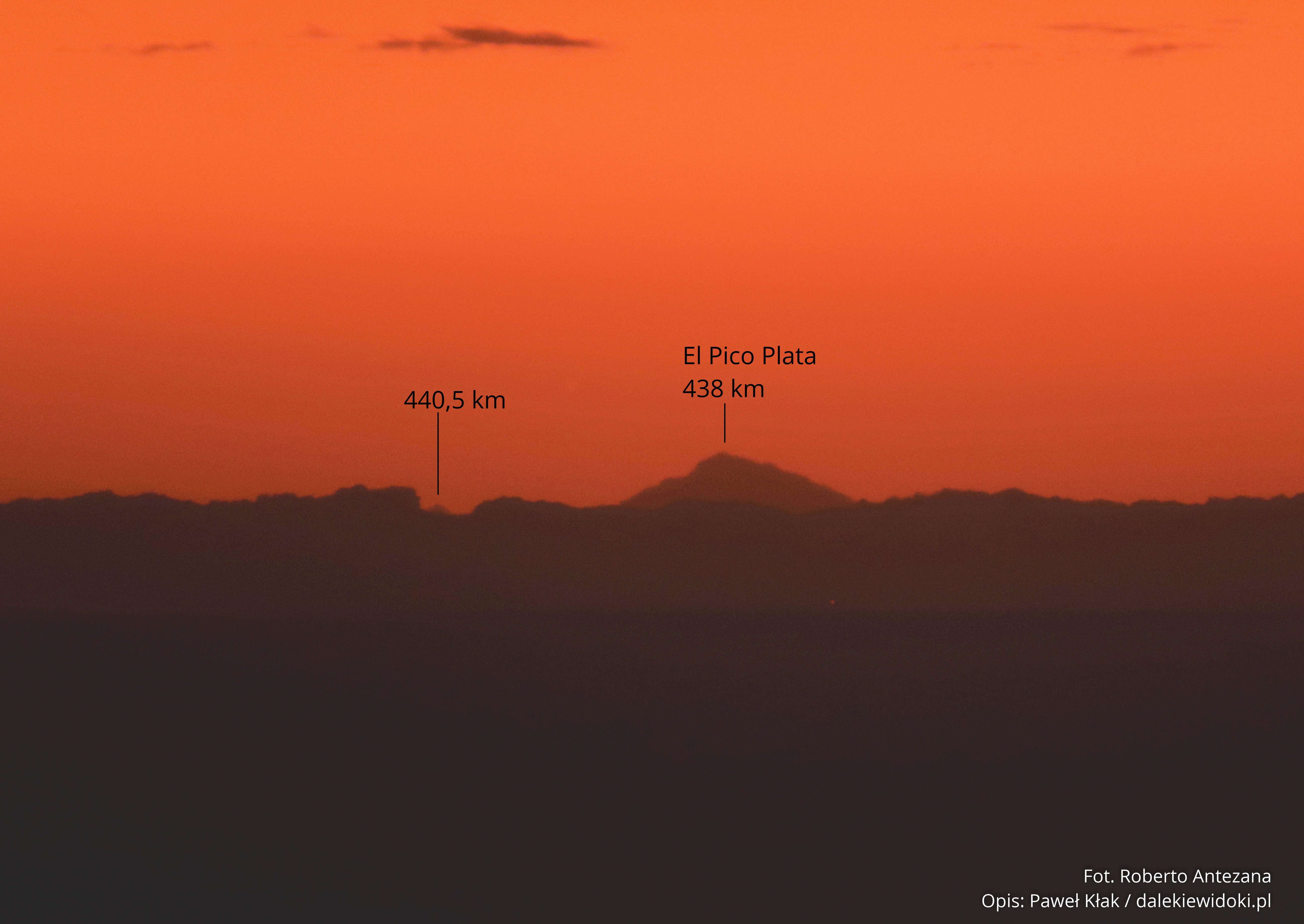
Photos depict: Himalayas Location: above the region of Calcutta – above Bara Pushkarini, flight QR 976 from Doha to Hanoi, and 23°43’26.7″N 86°35’18.1″E – above Barmuri Observer’s Altitude: 12,400 meters – cruising altitude Distance: Kanchenjunga ~ 522 km Simulation – Kanchenjunga SimulationMount Everest Simulation Date: February 23, 2019, flight QR 976 from Doha to Hanoi
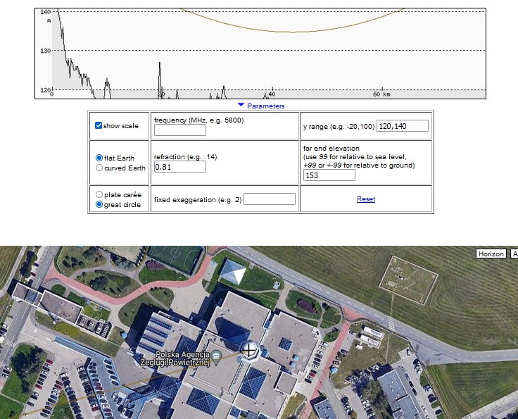
https://dalekiewidoki.pl/refraction_calc – Atmospheric Refraction Coefficient Calculator – calculate the atmospheric refraction coefficient at which point C is visible from point A exactly behind point B and Visibility Range Calculator – calculate the maximum visibility range considering Earth’s curvature and atmospheric refraction. https://dalekiewidoki.pl/en/tools//soundings.html – Select a station, data format, and date to download data and
Distant Observations, also known as Long-Distance Observations, is the process of recording terrestrial objects, both natural and anthropogenic, from a distant location on or above the Earth. The goal is to capture an object from the furthest possible distance, focusing on landscape elements such as mountains or anthropogenic structures. There are two categories of Distant


Poprawiłem opis jednego szczytu w widoku ze szczytu Příčný vrch , czasem wkradną się jakieś literówki.
Tak to było w sobotę rano. Były świetne warunki do DO. Zacząłem od Granicznego Wierchu (piękne miraże Tatr wyszły), potem…
Czy tak było wczoraj (w sobotę)? Jeśli tak, to fajnie, że ktoś pojechał w teren i wykorzystał warunki. Widziałem już…